Best Hikes near Minneapolis You Shouldn't Miss
From a fifty-foot waterfall inside the city to glacial potholes on the St. Croix, a field guide to twelve trails that earn a pair of good shoes.
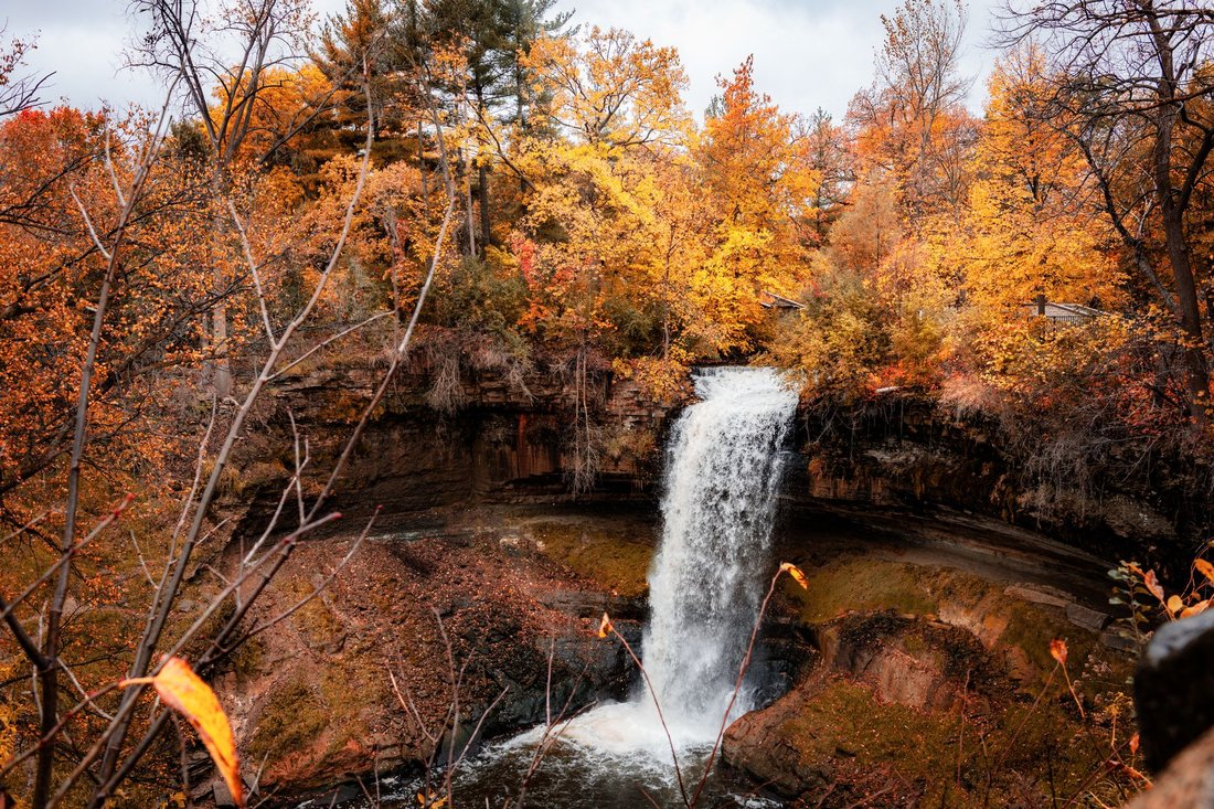
Mist drifts off Minnehaha Falls on an October morning, and the creek above the lip has turned the color of weak tea from fallen leaves. A jogger crosses the footbridge below while a couple in rain jackets leans on the stone railing, and somewhere past them a trail drops toward the Mississippi. This is where the best hikes near Minneapolis begin, and plenty of them never ask for more than a short drive.
Water shapes almost every good walk in the metro. Creeks and lakes organize the trail map, along with the river bluffs, and the two big cities treat them differently. Minneapolis leans toward parkway paths and urban woods, St. Paul's riverfront runs wilder through the bottomlands, and the state parks and park reserves beyond both stretch the options into real day-hike country. The twelve places below move outward from downtown Minneapolis, with a note on what each one offers and what to do there, plus when to go.
The best hikes near Minneapolis begin inside the city limits
Four of the strongest outings sit within a bike ride of Nicollet Mall. They are free to enter and reachable without much planning, and they are good enough that longtime residents keep returning.
Minnehaha Regional Park
Minnehaha Falls is the postcard, and the postcard is accurate. Minnehaha Creek travels out of Lake Minnetonka, crosses the southern half of the city, and tips over a limestone ledge in a single drop of about fifty feet before running down a wooded ravine to the Mississippi. The park around it, in the Longfellow area, has old stone walls and a limestone bridge, plus picnic lawns and enough shaded trail to fill a morning.
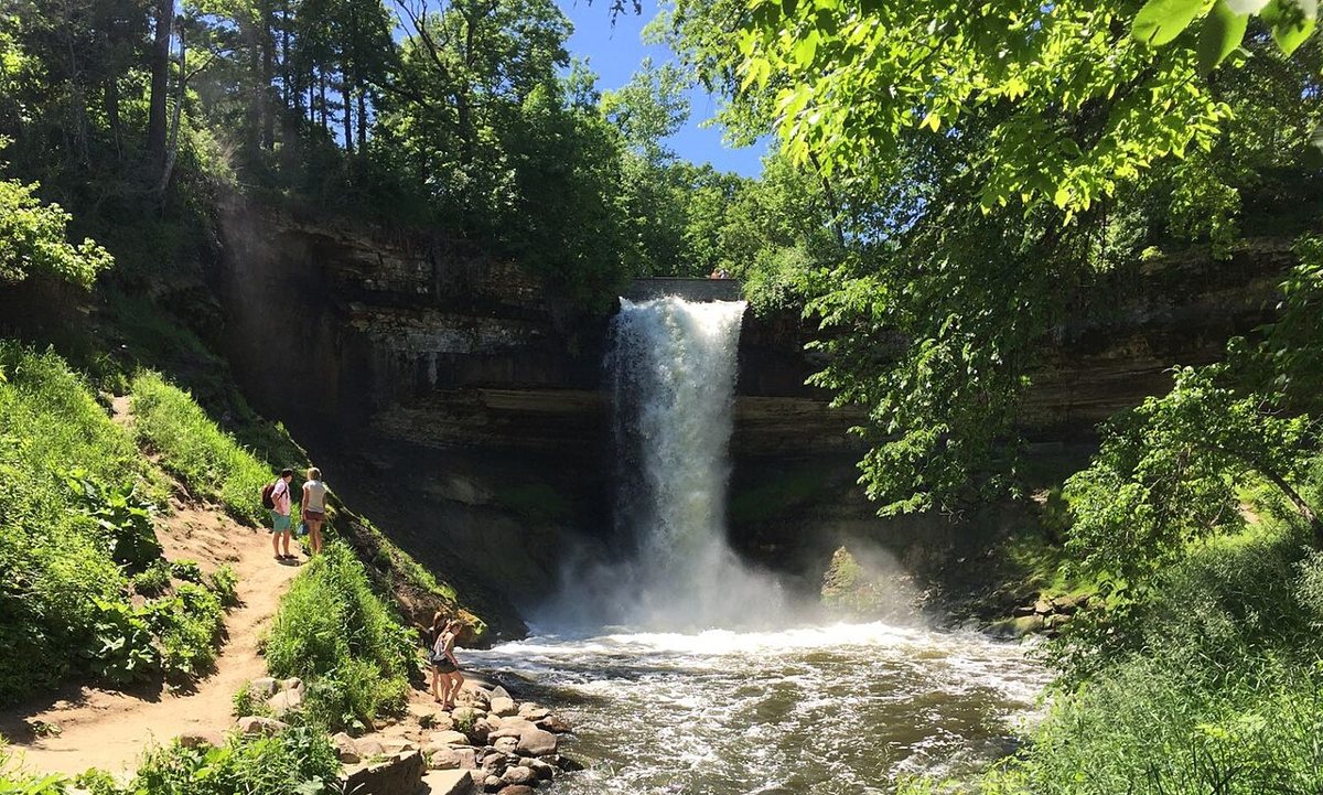

Start at the overlook, then take the stairs down to the base of the falls, where the spray cools the air on a July afternoon. From there the path follows the creek through the gorge to the river, and a walker can turn north or south along the bluff. The route is mostly paved near the falls and turns to dirt farther down, so shoe choice matters more than most visitors expect. Insider tip: the falls run strongest after snowmelt or a hard rain and can thin to a ribbon in late summer, so April and the day after a storm show the water at its loudest. In deep winter the whole drop freezes into a blue-white column, which makes a separate outing. Crowds gather near the overlook, and the quiet starts about five minutes down the gorge trail. The Blue Line light rail stops within walking distance, which makes this one a good car-free hike.
Mississippi Gorge Regional Park
Geologists and park planners often describe the stretch of the Mississippi between the Franklin Avenue area and Minnehaha as the only true gorge along the entire length of the river. Mississippi Gorge Regional Park protects both banks, and the west side holds the Winchell Trail, a natural-surface footpath that runs along the top of the bluff and drops to the river flats at points along the way. Oak woods close in above the water, small sandstone outcrops show through the slope, and the sound of the city fades faster than seems reasonable for a place this close to the University of Minnesota.
Walk it in one direction and have someone meet you at the other end, or turn around when the light changes. The trail is narrower and rootier than the paved parkway above it, so it feels like a real hike and takes longer than the map suggests. After a rain the steeper sections get slick, and in spring the gorge fills with migrating songbirds, so a pair of binoculars earns its place in the pack. The area also pairs well with a meal afterward. Cedar-Riverside, the center of Minneapolis' large Somali community, is a short drive upriver, and a plate of sambusas and a cup of spiced shaah is a fair reward for a muddy morning.
Theodore Wirth Regional Park
Theodore Wirth is among the largest parks in the Minneapolis system, a rolling expanse of oak woods and wetlands with open meadow on the city's northwest side. It holds the Eloise Butler Wildflower Garden and Bird Sanctuary, a seasonal woodland garden that has been a quiet landmark for generations, along with Wirth Lake and a web of trails that wander well beyond the main roads. Hikers can build a loop of a few miles without repeating a step, and the terrain stays interesting because the hills actually roll.
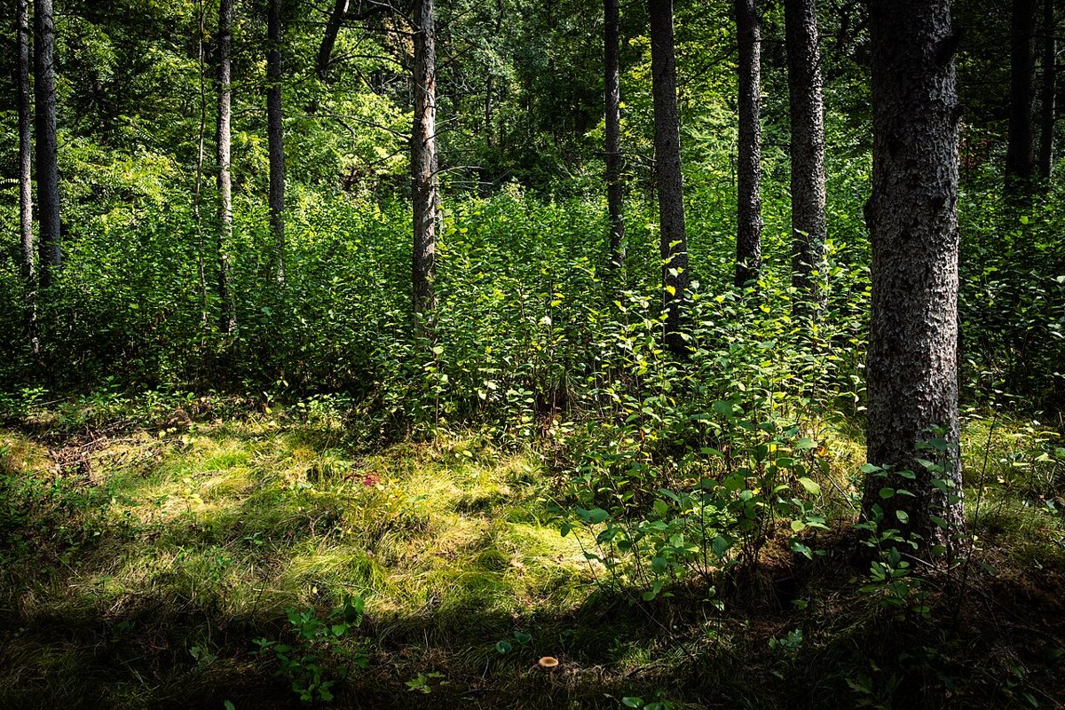

The Quaking Bog is the detail to seek out. It is a floating mat of sphagnum moss reached by boardwalk, and it behaves exactly as the name promises, with the ground trembling underfoot in a way that delights kids and sometimes startles adults. Spring brings wildflowers and a surge of warblers, and October turns the maples and oaks bright enough to rival anything up north. Worth knowing: the wildflower garden keeps seasonal hours and is quietest on weekday mornings, so plan around that, and expect mountain bikers on some of the dirt trails. Wirth is also a particularly useful place in town for winter walking, since the trail network stays open and the snowy woods look nothing like the same park in summer.
Bde Maka Ska and the Chain of Lakes
The Chain of Lakes is where Minneapolis does its everyday walking. Bde Maka Ska and Lake of the Isles join Lake Harriet and Cedar Lake to form a connected string of lakes ringed by walking paths, with separate lanes for bikes. Bde Maka Ska, the largest and busiest, carries a Dakota name meaning White Earth Lake, and its three-mile loop gives wide views of the water and the Uptown skyline. Lake of the Isles has a quieter, almost old-money feel, with islands that bring in herons and, in winter, skaters. Lake Harriet is the family favorite, with a bandshell and a rose garden at Lyndale Park, plus the Roberts Bird Sanctuary on its southwest side.
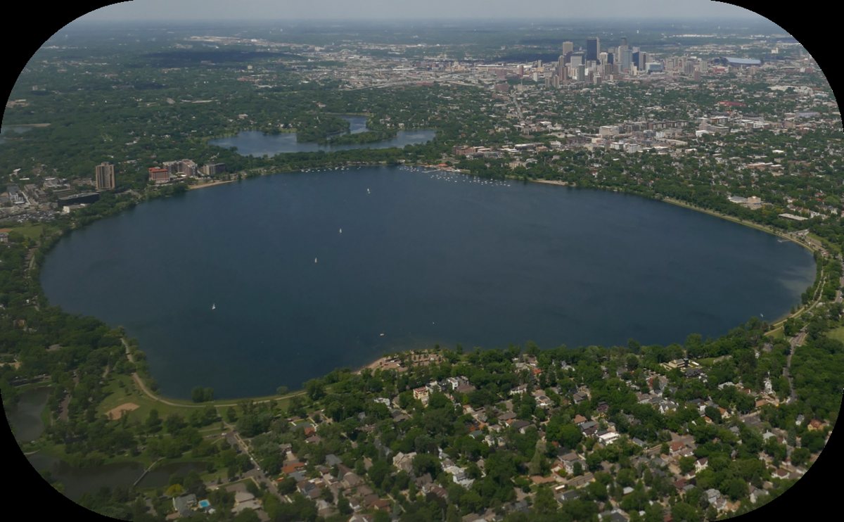

Anyone who wants something gentler than a trail can settle at a lakeside city park with a picnic, but the lakes also reward a longer walk. Stringing two or three together turns a stroll into a half-day outing of several miles, with a coffee or ice cream stop built in. Cedar Lake is the wilder sibling, with dirt paths through trees and a quieter shoreline that the other lakes lack. Locals tend to treat the Roberts Bird Sanctuary as the best birding in the chain during spring migration, and the lakeside paths fill with a cross-section of the whole city on a summer evening, from East African families gathered on the grass to rowers, with runners and kite flyers mixed in.
River valley trails where the Twin Cities meet
The Mississippi and Minnesota rivers meet just south of the city, and the land around that confluence holds some of the metro's best walking. These trails cross the line between Minneapolis and St. Paul, which is a good reminder that the Twin Cities share geography even when they argue about everything else.
Fort Snelling State Park
Fort Snelling State Park sits where the Minnesota River joins the Mississippi. The Dakota call this place Bdote, and it holds deep meaning in Dakota history and creation stories, which makes it more than a scenic stop. The park's best walk is the loop around Pike Island, a flat, wooded point of land between the two rivers. The trail runs a few miles through cottonwoods and silver maples with water showing through the trees on both sides.
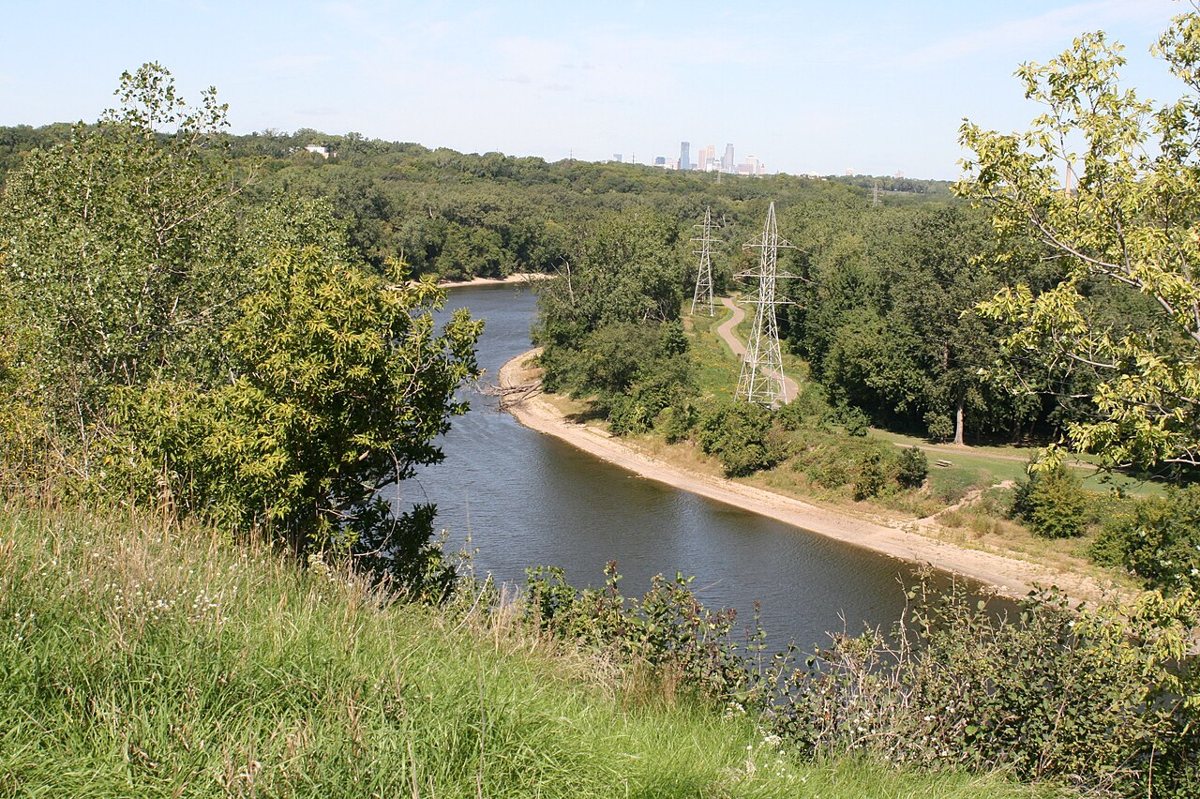

The island is easy walking, which makes it a strong choice for families and for anyone testing out a new pair of boots. Dawn brings the best light and the most wildlife, including bald eagles over the water and white-tailed deer along the path. The river flats below the old fort also carry painful history, since Dakota women and children, along with elders, were held there through the winter after the 1862 US-Dakota War, and the park and the nearby historic site are honest about that story. Check conditions before driving out in spring, because the floodplain closes when the rivers run high, and remember that state parks require a vehicle permit.
Hidden Falls Regional Park
Hidden Falls Regional Park sits on the St. Paul side of the Mississippi in the Highland Park area, and it takes its name from a small spring-fed cascade tucked into a ravine near the river. The falls themselves are modest, but the setting is excellent: shaded trails, a boat landing and picnic grounds, plus a floodplain forest that feels remote from a neighborhood of ordinary streets. The paved river trail suits strollers and bikes, while the dirt paths up the bluffs give walkers some elevation and a little solitude.
Spring is the time to go, when the ravine is loud with runoff and the forest floor fills with early flowers. A good call: pair this walk with the next park downstream, since trails along the river link the two and the route makes a long, easy outing with almost no elevation to worry about. Park near the boat landing, walk the river trail in one direction, then loop back along the bluff.
Crosby Farm Regional Park
Crosby Farm Regional Park is a long ribbon of floodplain forest along the Mississippi near its meeting with the Minnesota River. Boardwalks cross wetlands, and small lakes interrupt the woods while the trail runs under cottonwoods and silver maples that tower overhead. It is flat and quiet, and surprisingly wild, and on a weekday morning a walker can go a long time without meeting anyone.
Birders treat Crosby as a sure thing during migration, when warblers and waterfowl pass through the wetlands in numbers. Turtles sun on logs in the ponds, and the river itself carries barges and, in season, plenty of paddlers. Low sections of the trail flood after heavy rain or high water, so check the weather first and wear shoes that can handle mud. Bring bug spray in summer, because the same wetlands that attract so many birds also raise a healthy crop of mosquitoes.
Minnesota Valley National Wildlife Refuge
The Minnesota Valley National Wildlife Refuge follows the Minnesota River through the southern metro, protecting wetlands and hardwood bottomlands along with grassland that would otherwise be lost to development. The refuge visitor center sits in Bloomington, and from there a handful of trail systems wander through the valley, some on boardwalks over marsh and others on packed dirt through the trees. This is a different kind of hiking, slower and more observational, built around what lives in the water and the branches.
Spring and fall are the peak seasons, when waterfowl pass through on the flyway and the cattails turn gold. Bald eagles hunt along the river year-round, and a quiet walker can see deer and herons, and the occasional fox. One local move: stop at the visitor center first for a trail map and a sense of current conditions, because the river valley floods and some paths close seasonally. Bring a camera with a long lens, or just patience, and plan on covering less ground than usual.
Big metro parks with real woods
The suburban ring holds some of the largest parks in the area, with miles of trail and a more remote feel than the city parks offer.
Lebanon Hills Regional Park
Lebanon Hills Regional Park, in Eagan, is the kind of place that surprises people who assume the south metro is all parking lots. Wooded hills and small lakes fill a large stretch of land along with wetlands, and an extensive trail network supports hikers, mountain bikers, and, in winter, skiers and snowshoers. A visitor center near the main entrance offers maps and a good orientation to the park.
The best approach is to pick a lake and hike a loop around it, then add a connecting trail if the legs hold up. Fall color is excellent, with oak and maple turning the hillsides rust and gold, and the park tends to feel calmer than the city lakes even on a sunny Saturday. Mountain bikers share the trails, so stay alert on blind curves and keep to the right, and check the visitor center for the current trail map before committing to a long route.
Elm Creek Park Reserve
Elm Creek Park Reserve, run by Three Rivers Park District in the northwest suburbs, is one of the largest parks in the Three Rivers system. Hardwood forest and wetlands spread across the reserve alongside restored prairie, and the trail network is large enough that a walker can pick a different route every visit for a year. The Eastman Nature Center anchors the park for families, with interpretive programs and trails that suit small legs.
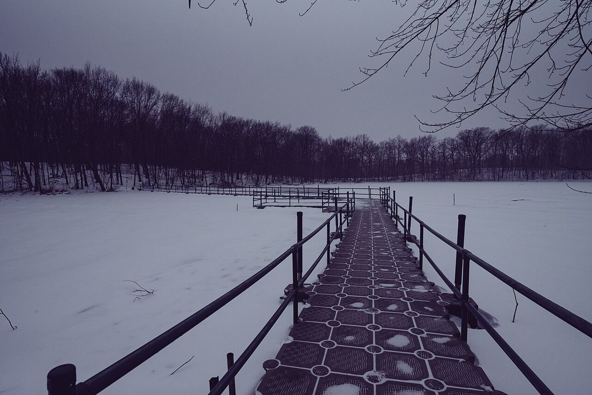

The reserve is especially good in late spring, when the woods turn green all at once and the prairie begins to flower, and again in October when the leaves peak. Go early, because the long trail loops pass through wetlands where frogs and birds are loud at dawn. Bring water, since the interior stretches are longer than they look on the map, and expect to share some trails with bikes.
Worth the drive: the river valleys east and north
Two state parks sit within an hour or so of the city and reward a full day. Each belongs on a list of a day trip from the Twin Cities, and each offers terrain that the metro cannot match.
Afton State Park
Afton State Park, on the St. Croix River east of the city, packs bluffs and deep ravines along with open prairie into a compact space. The trails climb through grassland, dive into wooded ravines, and finish at a sandy shoreline on the river, so a single hike covers more landscape types than most walks in the metro. The elevation changes are real, and the climb back from the river is the price of admission.
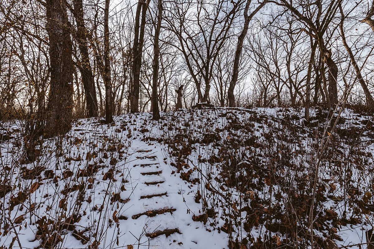

The park feels remote despite its distance from the city, and the view from the bluff top over the river valley is among the best in the region. Summer brings swimming at the beach and a campground for people who want to stay overnight, while fall color along the ravines is spectacular. Insider tip: carry more water than seems necessary, since the prairie sections offer almost no shade, and save time afterward for the village of Afton nearby, which has the kind of small-town main street that makes a good end to a hike.
Interstate State Park, Taylors Falls
Interstate State Park, at Taylors Falls, sits where the St. Croix River squeezes through a narrow basalt gorge known as the Dalles. Glacial meltwater drilled a field of deep potholes into the rock here thousands of years ago, and some of them drop dozens of feet. The Pothole Trail winds among them, while other paths follow the cliffs above the river, and rock climbers often work the walls. It is the most dramatic scenery within easy reach of the city.
The park works best as a full day, with time to walk and watch the river, then wander through the small town of Taylors Falls. Fall is the standout season, when the maples and oaks along the gorge turn orange and red and the water below runs dark. The rock near the potholes gets slippery when wet, so shoes with decent traction are worth bringing, and weekends in peak color draw crowds, so arrive early or visit midweek.
When to go, what costs money, and what to bring
The trails here are good three seasons out of four, and the fourth is better than its reputation. Spring brings waterfalls at full volume and wildflowers, along with mud, plus the first ticks of the year. Summer offers long evenings and swimming, though mosquitoes and humidity can wear on a long walk. Fall is the peak, with color usually reaching its height from late September into mid October and the bugs finally gone. Winter is a distinct experience rather than an obstacle: snowshoes open the park reserves and Minnehaha freezes into a sculpture, while a decent pair of traction cleats handles icy gorge paths.
Cost is easy to sort out. Minneapolis city parks and most regional park trails charge nothing to walk, and the lakes and the gorge fall into that group, as do Minnehaha and Wirth. State parks such as Fort Snelling and Afton and Interstate require a vehicle permit, and some park districts add fees for certain winter activities or programs, so check the park's website before leaving. The Minnesota Valley refuge trails are generally open without a fee, though the visitor center is the place to confirm.
A few habits make every trail better. Carry water and wear shoes with real tread. Apply tick repellent in spring and summer, and check clothing afterward, since deer ticks are common in the woods around the metro. Keep dogs leashed where required and stay on marked paths in sensitive wetlands. Carry out whatever comes in. Cell service fades in the river valleys, so download a map before heading into Crosby Farm or the refuge, and tell someone the plan before a longer route.
The takeaway
The best hikes near Minneapolis ask for very little. A free creek path and a Saturday morning will do, along with a decent pair of shoes, and the metro is generous enough to hand over a waterfall and a river gorge, then a wildlife refuge before lunch. What makes the Twin Cities unusual is not any single trail but the sheer number of them, scattered across two cities and three rivers, with dozens of lakes besides. Start with Minnehaha and the Mississippi Gorge, then work outward toward the river valleys to the east when the weather turns clear, and the whole region begins to read as one long, well-marked invitation to keep walking.